From Paper Utility Plats to
Digital Infrastructure Intelligence
Municipal water utilities use Geosys AI to visualize and explore water distribution networks — transforming scanned utility plats and legacy engineering drawings into a centralized spatial intelligence platform.
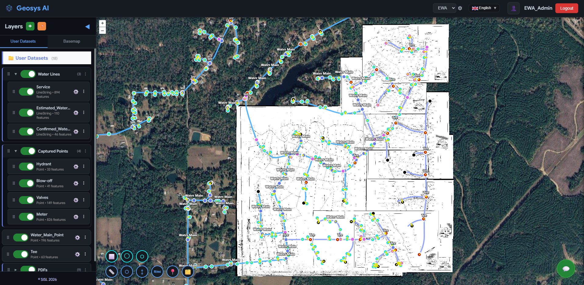
Network Visualization
Scanned utility plats were converted into a fully attributed GIS dataset and deployed into Geosys AI. Utility teams can now visualize color-coded water main pipelines, service pipes, valves, fire hydrants, blow-offs, tees, and water meters across the entire service network on an interactive map.
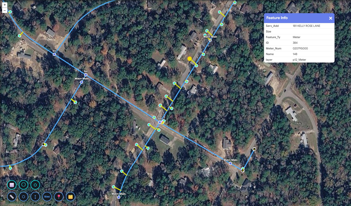
Asset Attributes & Infrastructure Filtering
Each infrastructure asset is linked with detailed attributes including pipe size, material type, service address, meter number, and year of installation. Utility engineers can click any asset to instantly review its full profile, and filter the entire water network by feature type, pipe material, pipe size, or installation period — isolating specific asset subsets such as all cast iron mains or pipes installed before 1980 to prioritize maintenance and plan replacements.
Natural Language Queries
Utility teams can query the infrastructure database using plain language — "Show all water mains larger than 12 inches", "Locate all fire hydrants within this service district", or "Identify pipes installed before 1980." What previously required reviewing multiple engineering drawings can now be answered in seconds.
Critical infrastructure records were locked in scanned documents and legacy drawings.
A client working with municipal water utilities managed historical infrastructure records stored in scanned utility plats and engineering drawings. These plats contained critical information about the water distribution network — pipelines, service pipes, valves, hydrants, blow-offs, and meters. Utility engineers had to manually search through old records to understand pipe locations, materials, installation years, or service connections. The client required a centralized platform where the entire water network could be visualized and explored spatially.
Before
- Water network records stored in scanned plats
- Manual search through engineering drawings
- Limited visibility of infrastructure network
- Slow access to asset information
- No centralized spatial platform for utility teams
After
- Fully mapped water distribution network
- Interactive infrastructure visualization
- Instant access to asset attributes
- Faster utility planning and maintenance coordination
- Centralized browser-based platform for all teams
Simple queries. Instant infrastructure intelligence.
Using plain language, water utility teams can instantly explore their infrastructure network. What previously required reviewing multiple engineering drawings can now be answered in seconds.
Not just digitized utility maps —
a complete water infrastructure intelligence platform.
Geosys AI enables utility teams to visualize, explore, and manage water distribution networks through a unified spatial platform. Water infrastructure intelligence — organized, accessible, and ready for operations.
- City-wide visualization of water distribution assets
- Quick access to hydrants, valves, and service connections
- Pipe size and material analysis across the network
- Historical infrastructure tracking by installation year
- Service address connectivity mapping
- Utility asset inventory management
Ready to deploy?
Get a demo, pricing, and a pilot plan tailored to your data stack.