From File Delivery to
Interactive Site Platform
A drone services provider uses Geosys AI to give construction clients a browser-based hub for orthomosaics, 3D models, surface layers, and live stockpile volume analysis — replacing scattered file deliveries with a single interactive platform.
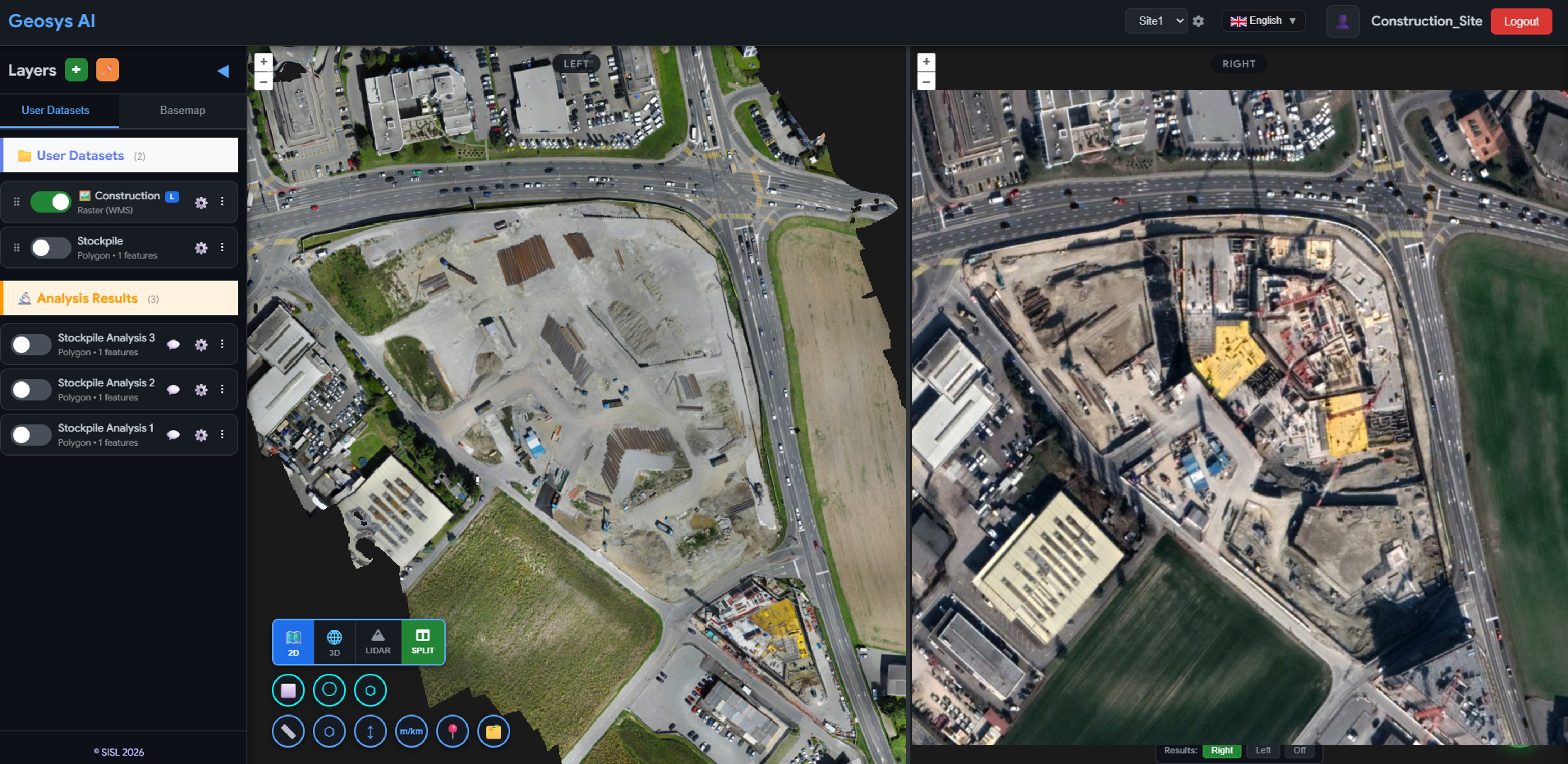
Temporal Change Analysis
Side-by-side comparison of orthomosaic imagery from different survey dates lets project managers instantly visualise earthwork progress, verify cut-and-fill operations, and detect unexpected changes — all without leaving the browser.
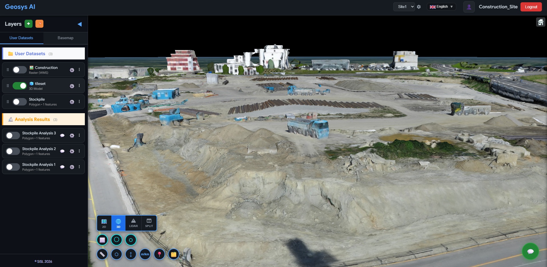
Interactive 3D Site Model
Photogrammetry-derived 3D models are streamed directly into the Geosys AI viewer. Teams can orbit, zoom, and measure the site from any angle — replacing heavy desktop software with a shareable browser link.
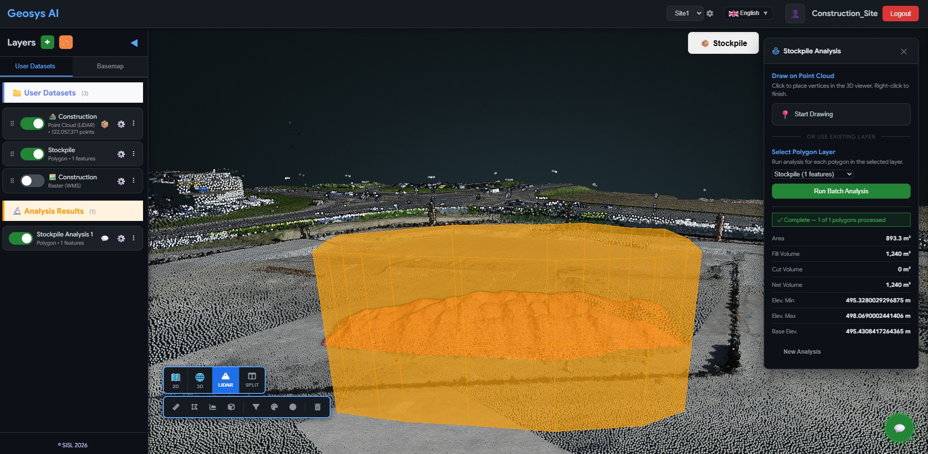
Stockpile Volume Analysis
Draw a boundary polygon around any stockpile on the LiDAR or DSM surface layer. Geosys AI calculates the volume (m³), base area, and height reference automatically — enabling rapid material quantity validation straight from the drone survey.
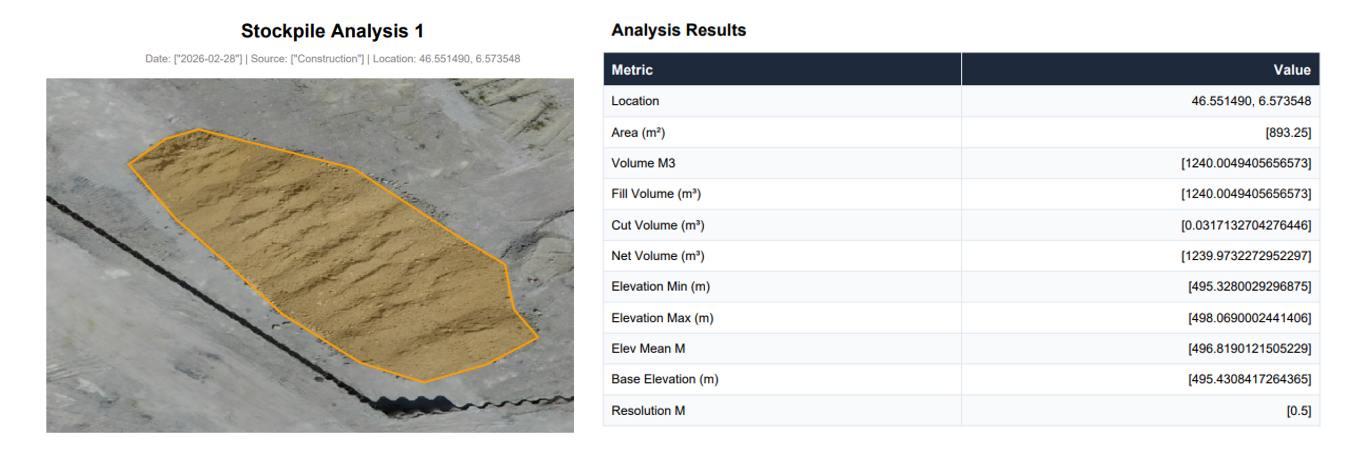
Automated PDF Reports
Export a formatted PDF report containing stockpile volumes, base measurements, map screenshots, and project metadata. Reports are generated on demand — removing the manual effort of assembling deliverables after each survey.
Survey data was hard to access and hard to use.
Construction clients were receiving drone survey outputs — orthomosaics, DSM/DTM surface models, 3D site models, and stockpile reports — as separate files over FTP or shared drives. Reviewing them required heavy desktop GIS or 3D software, creating friction for project managers who just needed a clear view of site progress.
Before
- OrthoTIFF files shared via FTP or cloud drives
- Separate DSM / DTM downloads
- Standalone 3D models requiring desktop software
- Manually assembled PDF reports
After
- Unified browser-based site viewer
- Layer toggle for ortho, DTM, DSM, and vectors
- Interactive 3D exploration in-browser
- On-demand stockpile volume calculation
Not just drone files —
a construction data platform.
The client now delivers a centralized, browser-based viewing experience alongside every drone survey. Construction teams validate stockpile volumes, review site progress in 3D, and export professional reports — all without specialist software.
- Browser-based site viewer — no GIS software needed
- All datasets unified: ortho, DSM, DTM, 3D, vectors
- On-demand stockpile volume calculations
- One-click PDF report generation
- Secure, centralized access for all project stakeholders
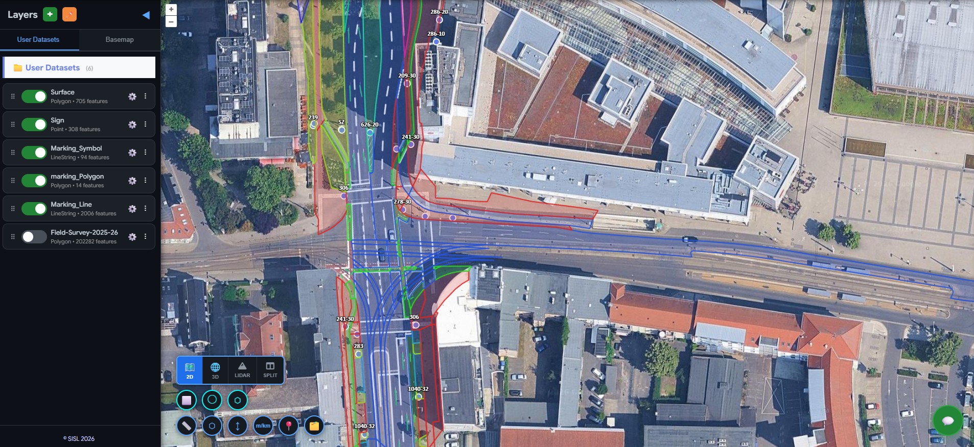
Urban Infrastructure
Street Asset Intelligence
Street signs, road markings, bicycle lanes, sidewalks, and urban green space mapping.
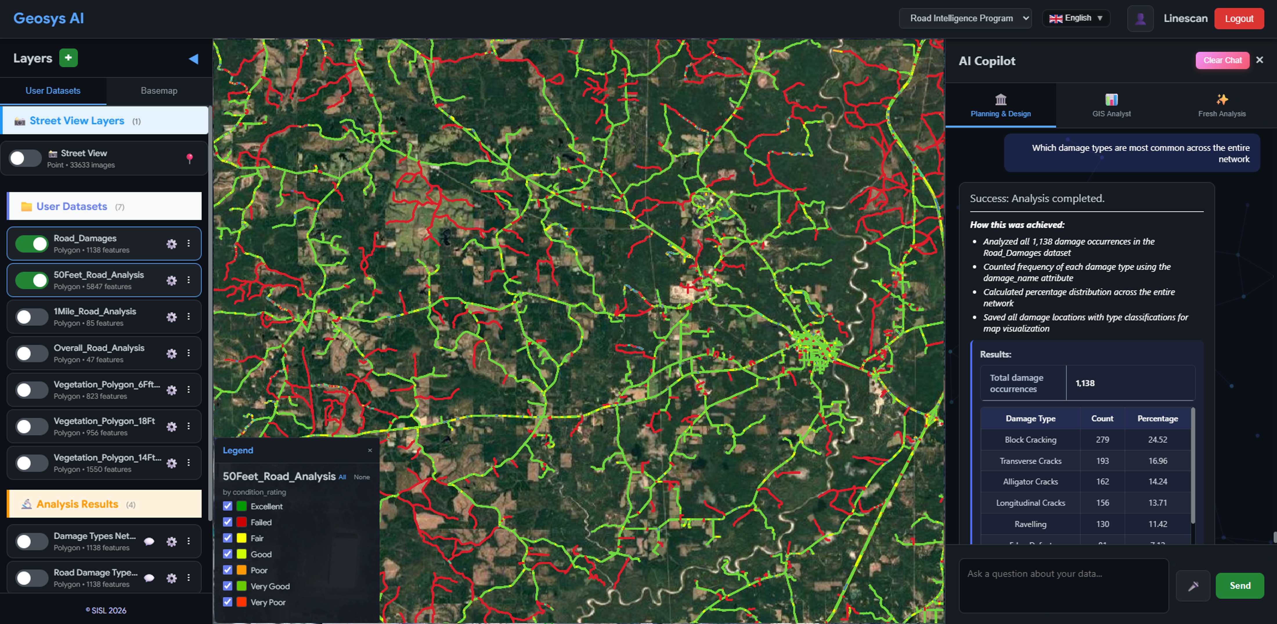
Infrastructure
Road Condition Intelligence
Hotspot detection, budget simulation, and grant-ready reporting for city and county councils.
Ready to deploy?
Get a demo, pricing, and a pilot plan tailored to your data stack.