From Static GIS Files to
Interactive Street Intelligence
City and municipal authorities use Geosys AI to visualize street signs, road markings, bicycle lanes, sidewalks, parking areas, and urban green spaces — transforming static GIS layers into a unified street asset intelligence platform.
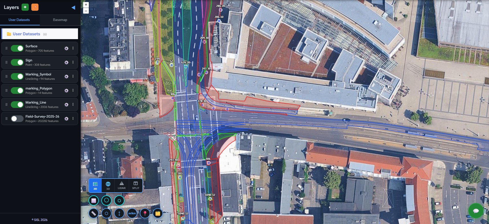
City-Wide Street Asset Visualization
All street infrastructure layers — roadway surfaces, lane types, bus lanes, bicycle lanes, sidewalks, parking areas, and traffic islands — are deployed onto an interactive city map. Transportation planners can pan, zoom, and click any asset to view its attributes without any GIS expertise.
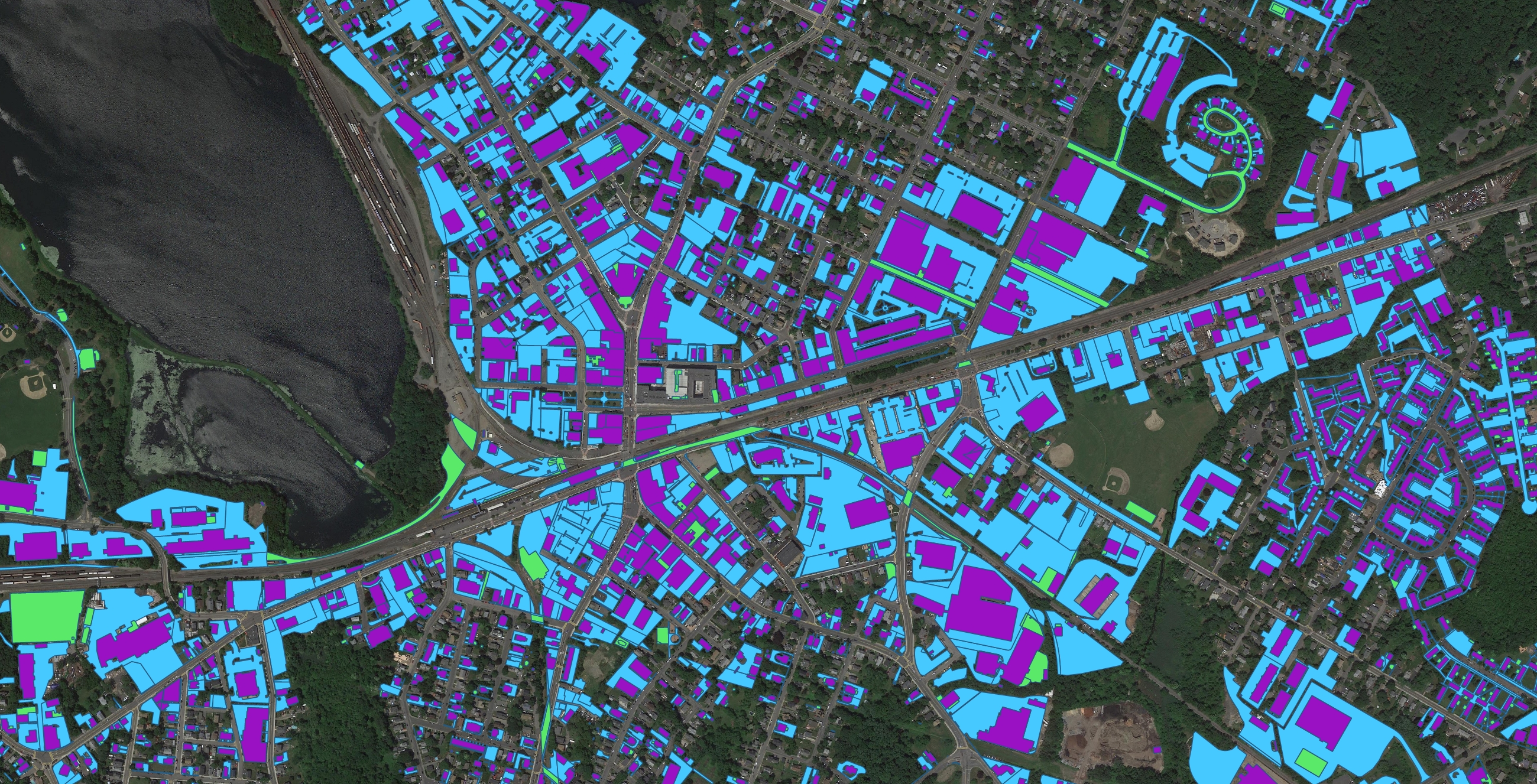
Mobility Corridors & Asset Inventory
Explore dedicated bicycle infrastructure, bus lane corridors, and shared mobility pathways alongside traffic signs and road markings. Urban planners gain clear visibility into transport mode distribution, signage density, and marking zones — filtering by type, category, or corridor to plan inspections and identify network gaps.
Natural Language Queries
City planners can query the entire street asset database using plain language — "Show all streets with bicycle lanes but no adjacent green buffer", "Identify corridors where bus lanes and bicycle lanes overlap", or "Calculate the total length of bicycle lanes in District A." What previously required manual GIS analysis can now be answered instantly.
Valuable street data existed — but was locked inside static GIS files.
The client managed detailed street infrastructure datasets collected from surveys and mapping programs — street signs, road markings, roadway surfaces, bicycle lanes, bus lanes, sidewalks, parking areas, and urban green spaces. But these datasets were delivered as static GIS files that city officials and planners couldn't explore without GIS expertise. Transportation planners, maintenance teams, and urban designers needed an interactive platform to visualize and manage street assets across the entire road network.
Before
- Street infrastructure stored in separate GIS layers
- Limited access outside specialized GIS teams
- Manual map preparation for analysis
- Slow decision-making for transportation planning
- Spreadsheet-based consolidation for corridor reviews
After
- Unified city-wide street asset platform
- Interactive visualization of transportation infrastructure
- Easy exploration of street layers by category or corridor
- Faster corridor analysis and planning
- Accessible to planners, engineers, and city officials
Simple queries. Instant street intelligence.
Using plain language, city planners and infrastructure teams can instantly analyze street infrastructure across the city. What previously required manual GIS analysis and multiple datasets can now be answered in seconds.
Not just street asset datasets —
a complete urban street intelligence platform.
Geosys AI enables cities to visualize, manage, and understand their street networks through a unified interactive platform. Street infrastructure intelligence — organized, accessible, and ready for planning decisions.
- City-wide visualization of street assets — no GIS expertise required
- Corridor-level mobility planning for bicycle, bus, and pedestrian networks
- Sidewalk and pedestrian infrastructure monitoring across neighborhoods
- Street signage and road marking inventory at your fingertips
- Natural language queries for instant street infrastructure insights
- Corridor-level summaries for transportation planning and review
Ready to deploy?
Get a demo, pricing, and a pilot plan tailored to your data stack.