From Asset Inventory to
Corridor Intelligence
A highway authority uses Geosys AI to give operational teams a browser-based platform for 3D asset visualisation, cross-layer analysis, and natural language corridor queries — no CAD or GIS expertise required.
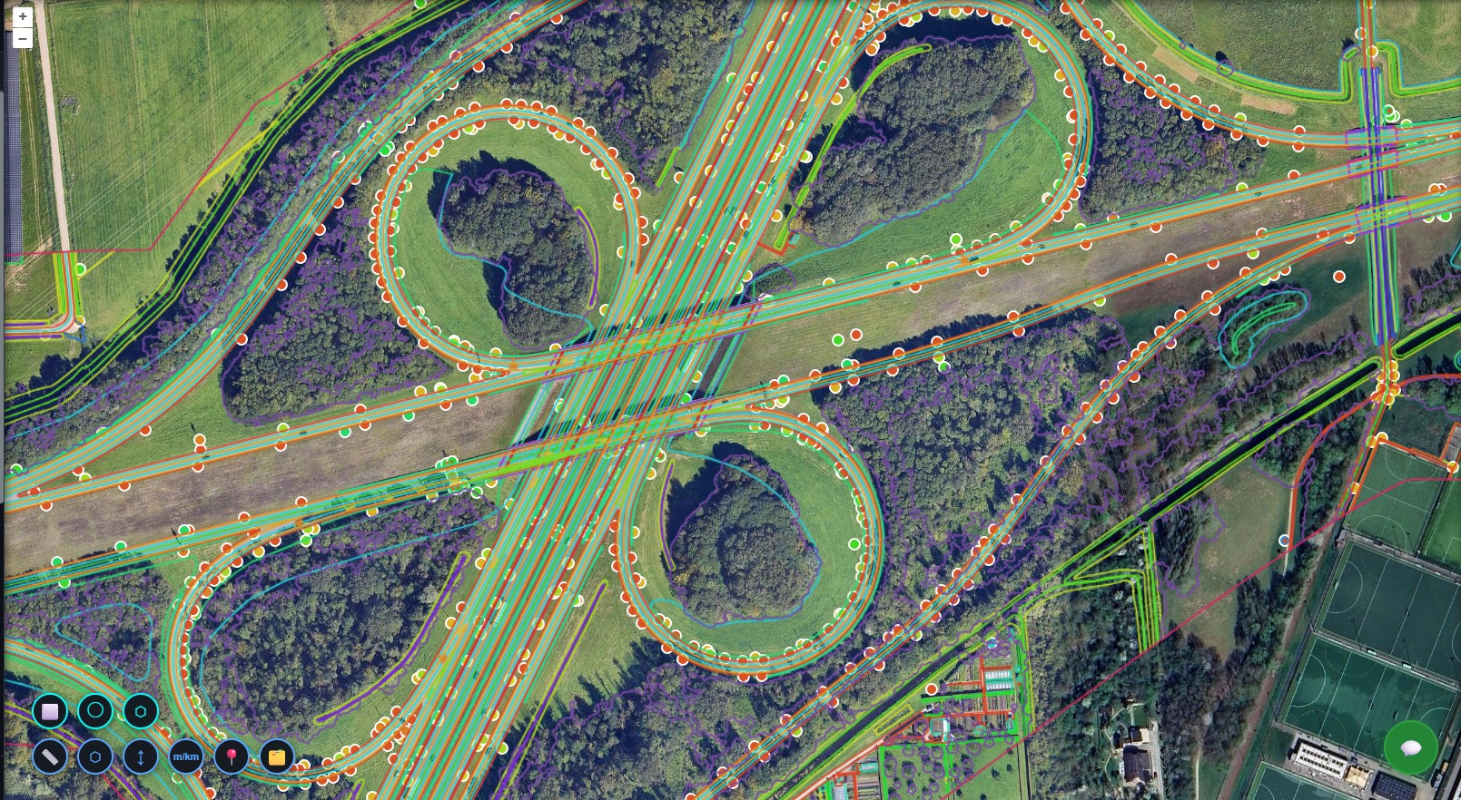
Corridor Visualisation
All point, line, and green asset layers — converted from CAD — are deployed into a single interactive environment. Highway teams can pan, zoom, and navigate by chainage or hectometer reference to locate any asset along the full corridor without opening a CAD or GIS application.
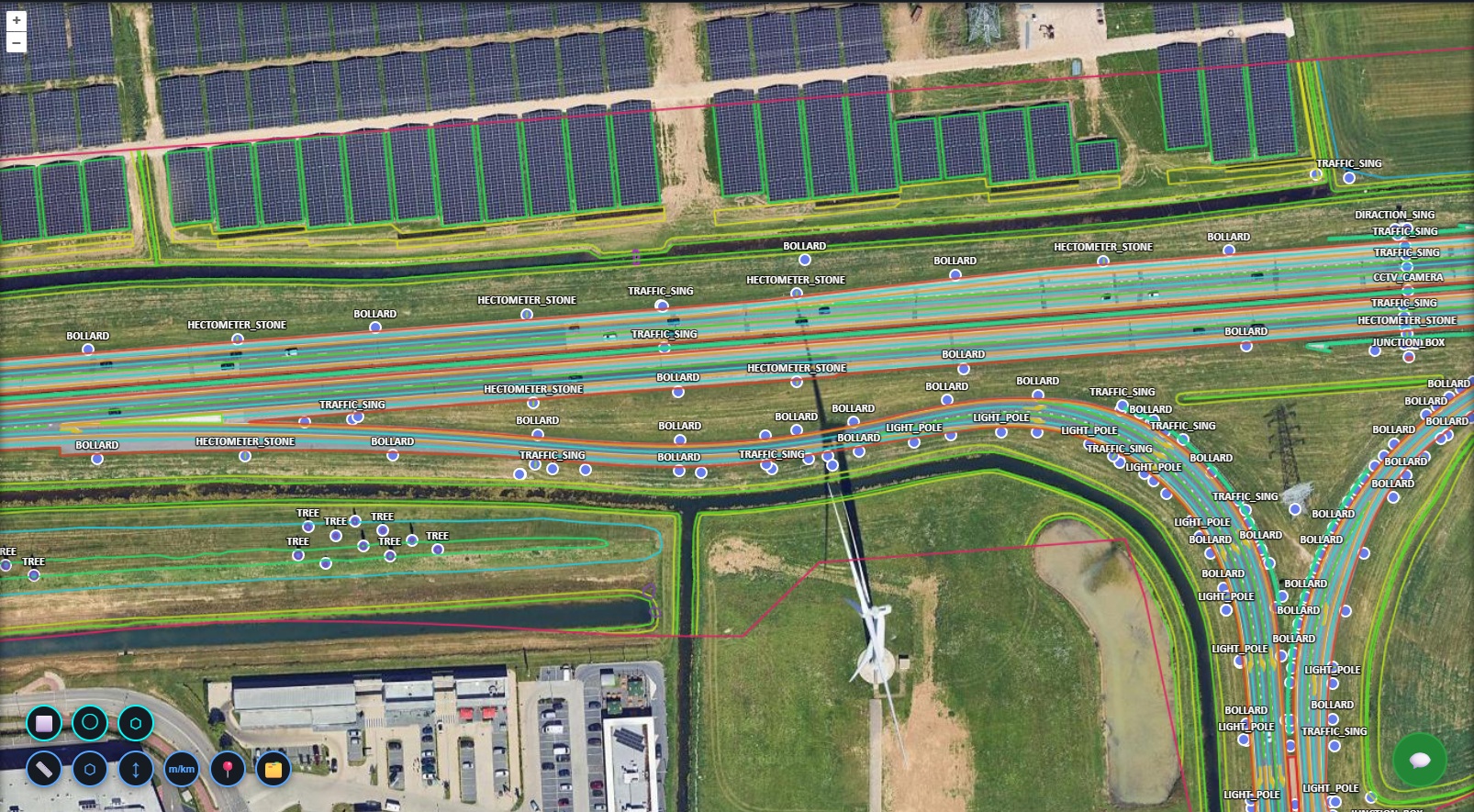
Point Assets
Line Assets
Asset Registry & Filtering
Filter the corridor by asset type — guardrails, traffic signs, drainage channels, CCTV cameras, lighting, and more — and instantly surface counts, lengths, and locations. Cross-layer queries identify maintenance-critical assets and flag infrastructure requiring attention without any manual spreadsheet work.
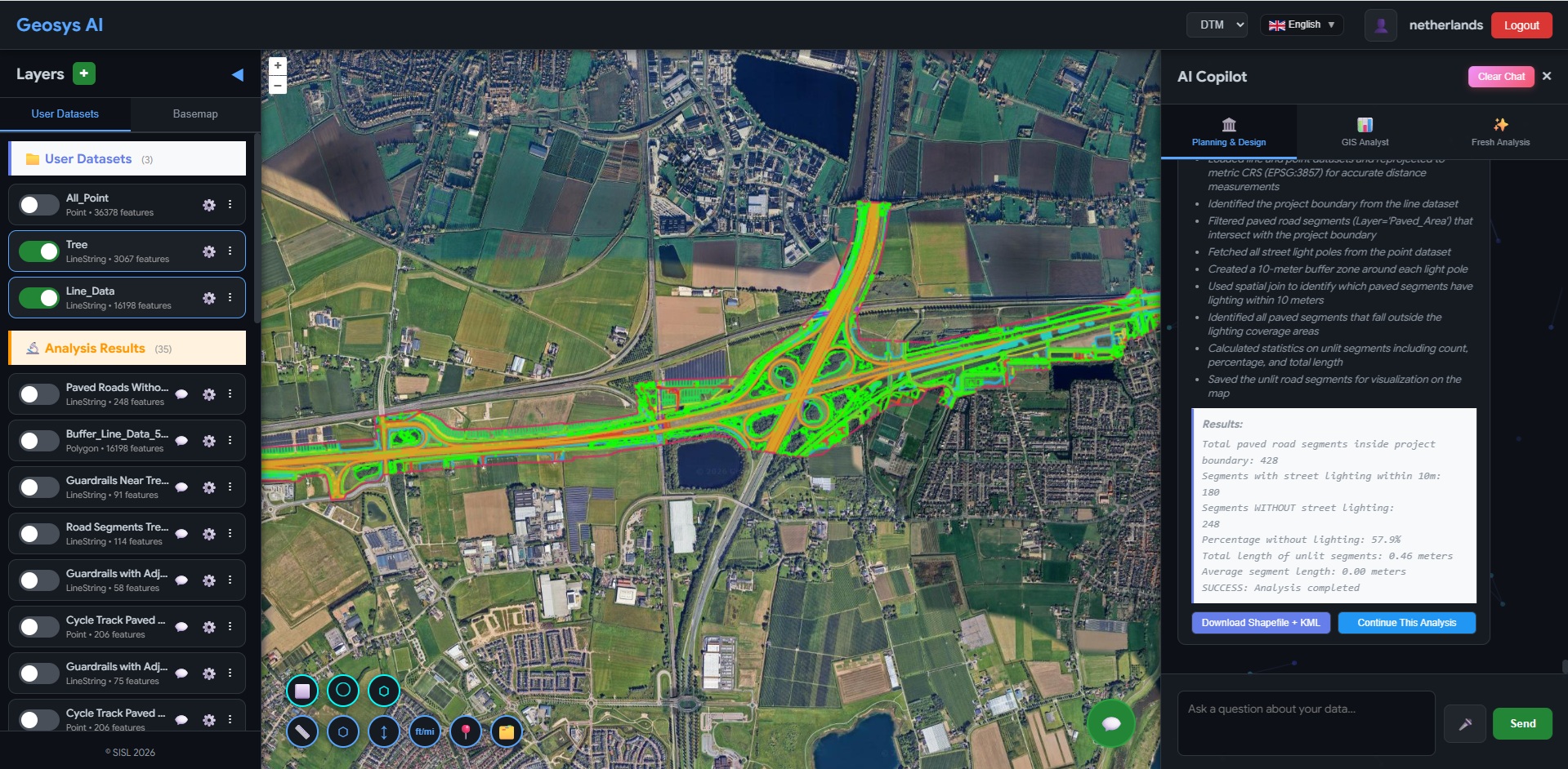
Show all guardrails within 5 km of Project Boundary.
Count CCTV cameras along the full corridor section.
Identify slopes above threshold near retaining walls.
List traffic signs missing within 500m of bridge sections.
Show drainage channels near areas with dense vegetation.
Generate asset inventory summary for Section A.
Natural Language Queries
Teams can type questions like "Show all guardrails within 5 km of the project boundary" or "List traffic signs missing near bridge sections" and receive instant, mapped answers. What previously required layered GIS workflows and specialist expertise now takes seconds.
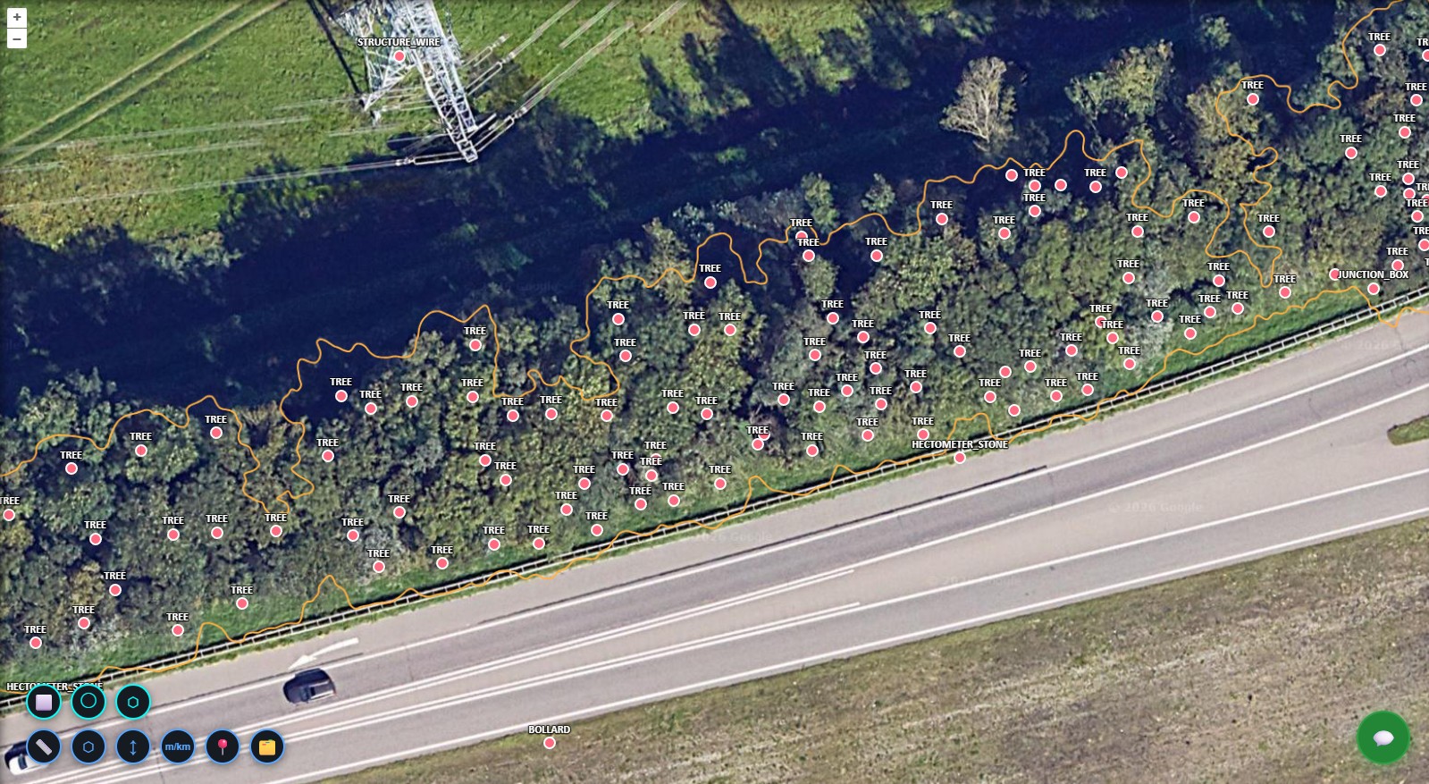
Vegetation & Environment Layer
Forests, roadside vegetation, shrubs, and landscaped areas are mapped alongside infrastructure assets. Teams can detect vegetation proximity to guardrails and signage, monitor greenery along slopes and drainage channels, and identify environmental zones along project boundaries — supporting safety compliance and visibility management.
Critical infrastructure was locked in static CAD files and disconnected layers.
The highway authority had comprehensive 3D asset data — thousands of point assets, kilometres of line features, and detailed vegetation mapping — but it was trapped in CAD files and siloed GIS layers. Cross-layer analysis required specialist intervention, maintenance prioritisation was manual, and operational teams had no direct access to the data they needed.
Before
- Assets stored in static CAD or GIS files
- Cross-layer analysis required GIS specialists
- Maintenance prioritisation was manual
- Asset inventory audits were time-consuming
After
- Unified 3D corridor dashboard in the browser
- AI-driven cross-layer queries in plain language
- Instant asset filtering and inventory reporting
- Operational-ready exports for field and planning teams
Not just an asset map —
a dynamic 3D highway intelligence system.
The authority now operates a centralised, browser-based corridor intelligence platform. Field and planning teams filter assets, run natural language queries, and export maintenance-ready reports — without specialist software or GIS training.
- Browser-based portal — no CAD or GIS software required
- All 3D point, line, and green assets in one unified platform
- Asset filtering by type, location, and category in seconds
- Natural language queries answer corridor questions instantly
- Cross-layer analysis without specialist GIS expertise
- Maintenance and procurement exports generated on demand
Ready to deploy?
Get a demo, pricing, and a pilot plan tailored to your data stack.