From Field Records to
Spatial Agriculture Intelligence
Sugar mills and agricultural cooperatives use Geosys AI to visualize thousands of farmer plot parcels, monitor crop management activities, and generate operational insights — transforming mobile field data into a unified Agriculture intelligence platform.
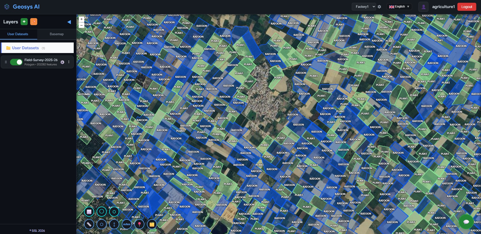
Interactive Plot Visualization
All farmer plot parcels collected through the mobile field application are deployed onto an interactive map. Plantation managers can pan, zoom, and click any parcel to view linked farmer details, GPS coordinates, planting dates, and crop variety — without any GIS expertise.
Weed Control Status
Identify farms where weed management has been completed or requires follow-up action
Mulching Activity
Track mulching progress across fields to monitor soil moisture retention practices
Spraying Records
Monitor pesticide and herbicide application records linked to each farmer plot
Ratoon Management
Track ratoon crop management activities including stubble shaving and gap filling
Plantation Activity Tracking
Track fertilizer applications (DAP, NPK, SSP, Potash), irrigation schedules, weed control, mulching, and spraying activities at the plot level. Field supervisors gain clear visibility into which farms have completed critical crop management activities and which require follow-up.
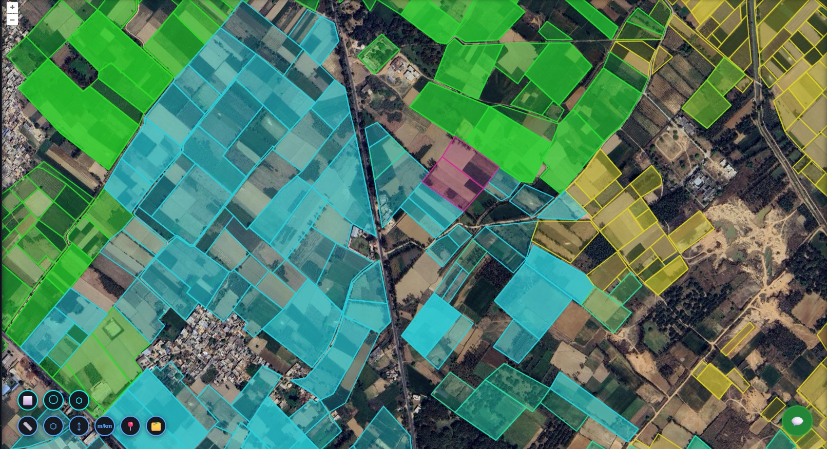
Multi-Dimensional Filtering
Filter the entire plantation network by village, farmer type, sugarcane variety, planting season, or planting method. Plantation managers can instantly isolate specific subsets of farms to review progress, identify gaps, and plan targeted field interventions.
Natural Language Queries
Agricultural managers can query the plantation database using plain language — "Show all plots planted with variety Co-15023", "Find farms where fertilizer application is incomplete", or "Identify villages with the highest planted area." What previously required consolidating multiple field reports is now answered instantly.
Plantation data was captured but couldn't be seen or analyzed spatially.
Field officers were collecting detailed plantation information — farmer identity, plot boundaries, crop varieties, planting methods, fertilizer usage, and crop management activities — through a mobile application. But the data sat in isolated databases. Understanding planting progress, monitoring crop practices, and planning mill supply required manual reports and spreadsheets across thousands of farm plots.
Before
- Field app data stored in isolated databases
- Limited spatial visibility of farm plots
- Manual reporting for plantation progress
- Difficult tracking of crop management activities
- Spreadsheet-based consolidation for mill planning
After
- Interactive map of all farmer plots
- Linked farmer and plantation data per parcel
- Real-time plantation monitoring across regions
- Village-level agricultural analytics
- Operational insights for plantation planning
Simple queries. Instant agriculture intelligence.
Using plain language, agricultural managers can instantly analyze agricultural activity across thousands of plots. What previously required consolidating multiple field reports can now be answered in seconds.
Not just plantation records —
a complete agricultural intelligence platform.
Geosys AI enables sugar mills and agricultural teams to monitor planting progress, track crop management activities, and manage farmer networks through a unified spatial platform. Agricultural intelligence — accessible, organized, and decision-ready.
- Interactive map of all farmer plots — no GIS expertise required
- Linked farmer identity, parcel boundaries, and plantation data
- Real-time monitoring of crop management activities
- Village-level agricultural analytics and progress tracking
- Natural language queries for instant operational insights
- Plot-level plantation summaries for operational review
Ready to deploy?
Get a demo, pricing, and a pilot plan tailored to your data stack.