Everything Your
Spatial Data Can Do
From upload to AI analysis, simulation, and white-label delivery - a complete tour of the Geosys AI platform.
Data & Integration
Every Format, One Platform
Bring every dataset you have into a single browser-based workspace. No conversions, no desktop GIS, no plugins - upload it and it is on the map.
01 / 05 — Data Format
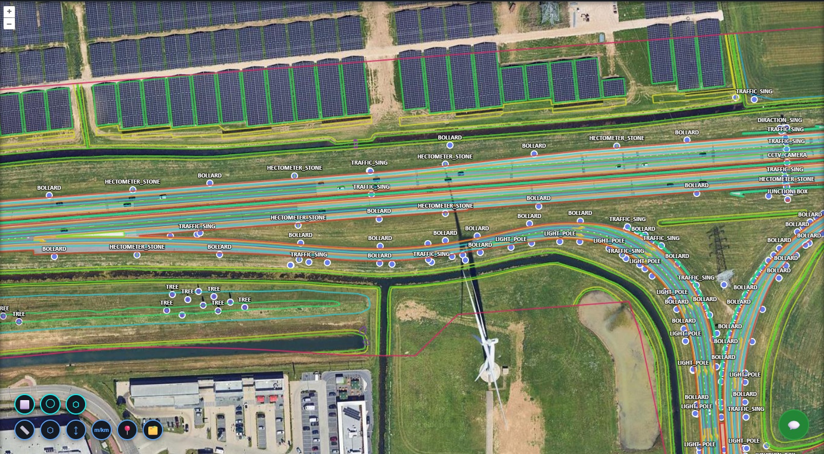
Vector
Shapefiles, GeoJSON, and GeoPackages rendered as live map layers.
02 / 05 — Data Format
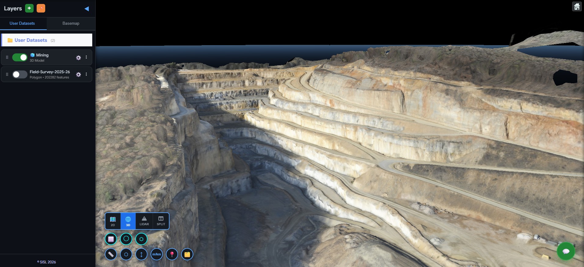
3D Models
OBJ, GLB, and GLTF models streamed on the globe as 3D tiles.
03 / 05 — Data Format
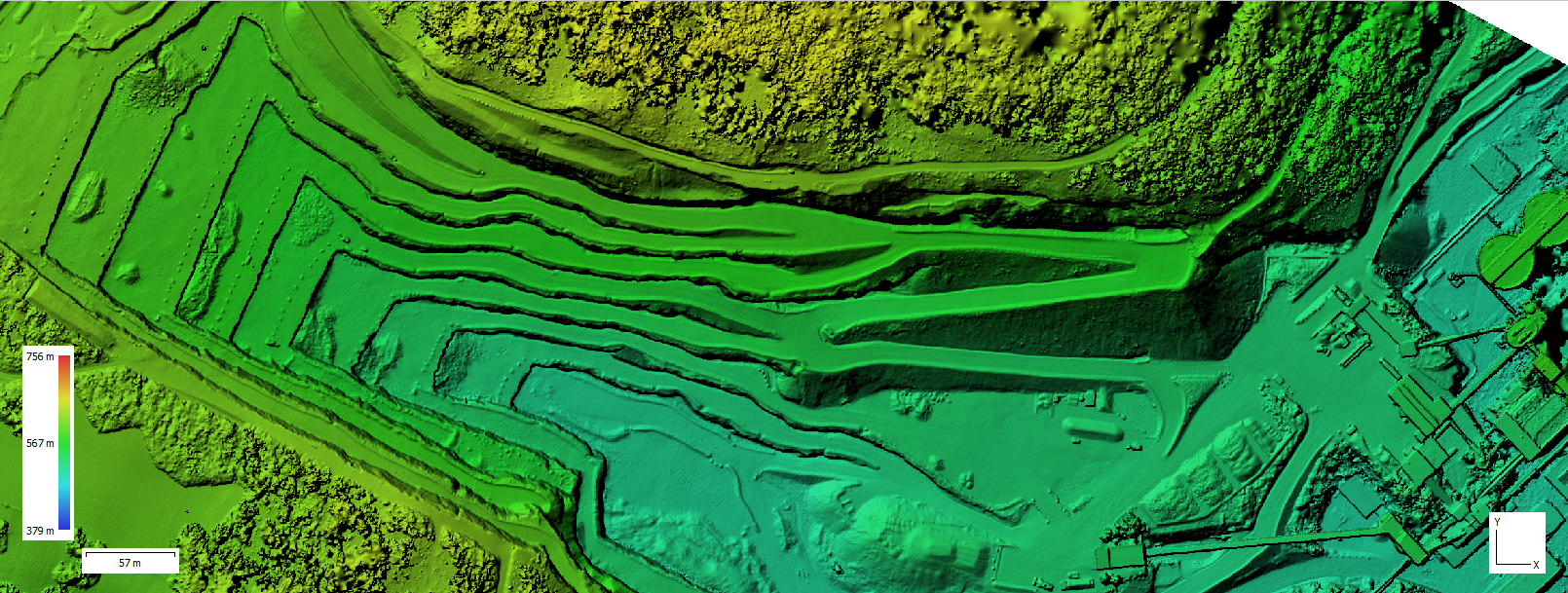
DEM
Color-shaded elevation surfaces ready for terrain analysis.
04 / 05 — Data Format
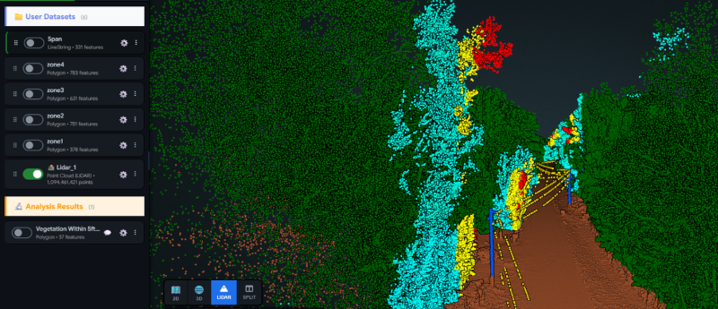
LiDAR
Millions of classified points, explored smoothly in the browser.
05 / 05 — Data Format
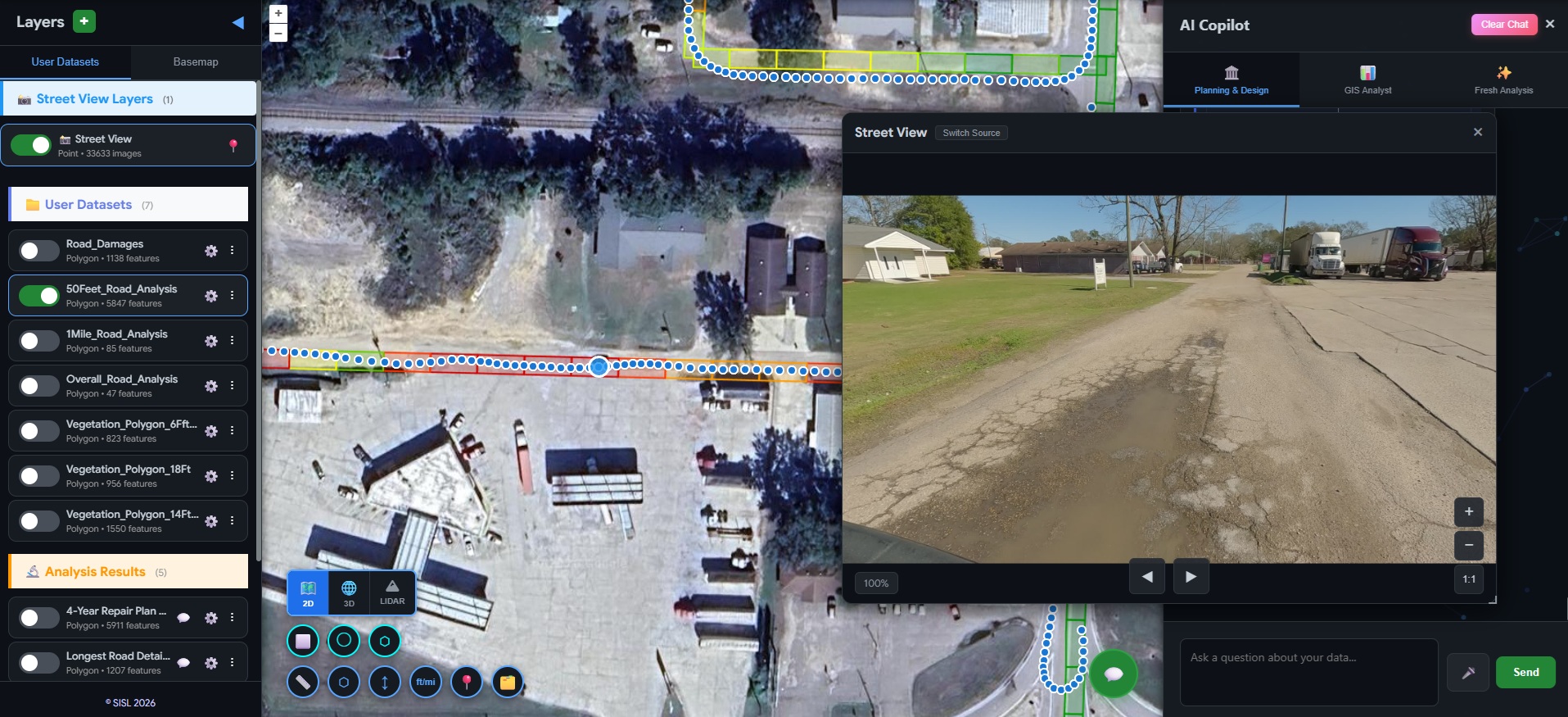
Street View
Ground-level panoramas synced with your map and analysis layers.
Vector Data
Upload Shapefiles, GeoJSON, and GeoPackages - including multi-layer GeoPackages that unpack into organized layer groups.
Drone Imagery & Rasters
Orthophotos and rasters are converted to cloud-optimized GeoTIFFs that stream straight to the browser at any scale.
LiDAR Point Clouds
Upload LAS/LAZ point clouds and explore millions of points smoothly in the integrated 3D viewer.
3D Models
Bring in OBJ, GLB, and GLTF models, position them on the globe, and share them as streamable 3D tiles.
CAD Drawings
DXF drawings convert to geospatial layers automatically, with CAD layers preserved as map symbology.
Spreadsheets
CSV and Excel files become queryable datasets - and turn into map layers when they contain coordinates.
Live SQL Databases
Connect PostgreSQL or SQL Server directly, browse schemas, and analyze live tables or saved snapshots.
PDF Map Georeferencing
Pin scanned PDF maps to real-world coordinates with a guided control-point workspace.
External Map Services
Add WMS, WMTS, and WFS services from any provider alongside your own data.
Street-Level & Oblique Imagery
Geotagged photos, 360-degree panoramas, and five-camera oblique aerial surveys, viewable in place on the map.
AI Analysis
Ask Questions, Get Map Layers
Describe what you want to know in plain language. Geosys AI plans the analysis, runs it, and delivers results as layers, charts, and reports you can audit.
Natural-Language Queries
Ask spatial questions in plain English and get answers as ready-to-use, styled map layers.
Transparent & Auditable
Every analysis runs as readable, inspectable code - no black box between your question and the result.
GeoAgent Workflows
Build step-by-step analysis pipelines visually: clarify, choose datasets, edit any step, and reuse the flow across projects.
AI Terrain Analysis
Compute slope, aspect, hillshade, contours, and elevation profiles directly from your elevation models - just by asking.
Inline Charts
Bar, line, pie, scatter, histogram, and box charts render right inside the conversation.
Conversation Reports
Roll an entire analysis session into a polished report, exportable as HTML, PDF, or DOCX.
Saved Reports
Save parameterized analyses and re-run them on demand - same logic, fresh data.
Simulation Engine
Physics on Your Terrain
Run physical simulations directly on your elevation data - from instant visual what-ifs to persisted engineering runs with downloadable reports.
Solar Insolation
Model yearly solar energy over terrain with clear-sky irradiance and hard terrain shadows.
Flood Modeling
Physics-based rain-on-grid flood simulation with depth, velocity, hazard class, and arrival time.
Viewshed Analysis
See exactly what is visible from any observer point across the terrain.
Hydrology
Derive flow direction, stream networks, and drainage basins from a DEM in minutes.
Sink Detection
Find and classify surface depressions by severity - ponding risk at a glance.
Rooftop Solar PV
Per-building PV yield with economics: capacity, payback period, ROI, and CO2 savings.
Plain-English Simulations
Describe the scenario in chat - the AI picks the right simulation and sets it up for you.
Engineering Reports
Persist simulation runs, revisit them anytime, and export engineering-grade PDF reports.
Visualization
See Everything, Together
One map for all of it: 2D, 3D globe, point clouds, imagery, and animated data overlays - with the tools to move between them fluidly.
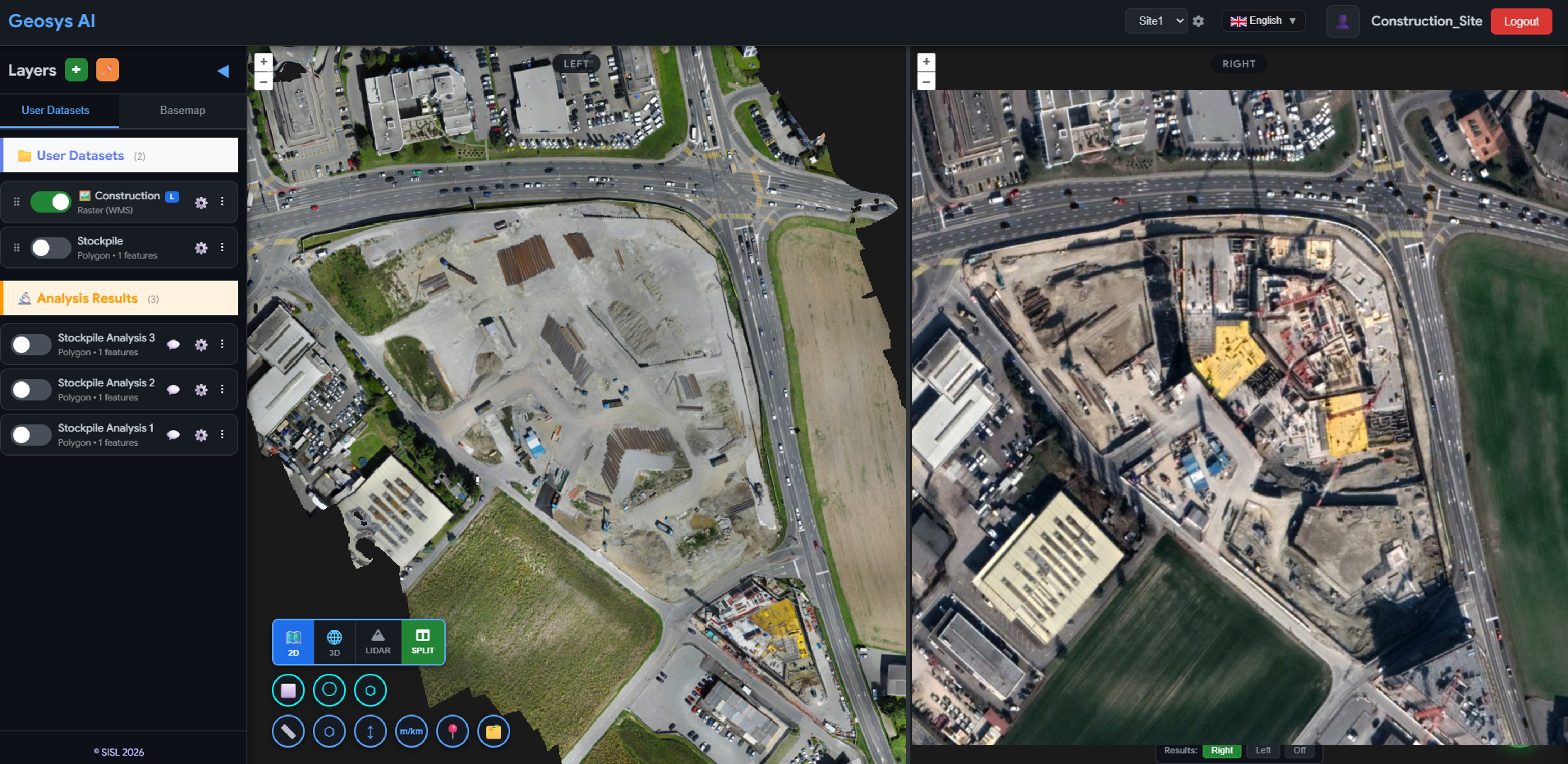
Unified 2D & 3D
Switch between a fast 2D map and a full 3D globe without losing context.
LiDAR Split View
View the 2D map and the point cloud side by side with synchronized navigation.
Automatic Hillshade
Elevation rasters get a crisp hillshade rendering out of the box, with a one-click toggle.
360-Degree Street View
Walk through panoramic street-level imagery linked to points on the map.
Oblique Quad Viewer
Inspect a location from four cardinal directions at once with synchronized oblique views.
WebGL Data Overlays
Heatmaps, hex grids, arcs, columns, and animated trip playback for large datasets.
Timeline & Hotspots
Play your data through time and surface statistically significant emerging hotspots.
Drawing Tools
Sketch points, lines, and polygons on the map, then save them as permanent layers.
Map Bookmarks
Capture camera, layers, and filters as named views you can return to and share.
Custom Projections
Work in your national coordinate system - the map renders in the EPSG you configure.
Collaboration
Built for Teams
Projects keep data, analysis, and people organized - with permissions that map to how your team actually works.
Downtown Analysis
4 members
Highway Survey
7 members
Mine Site QA
3 members
Alex Chen
AdminSam Rivera
EditorPriya Shah
AnalystJordan Park
ViewerSam edited 12 attributes
2m ago
Priya ran vegetation analysis
18m ago
Storage quota approved
1h ago
Layer group "Utilities" shared
3h ago
Shared Projects
Organize work into projects and invite members with exactly the access they need.
Roles & Permissions
Viewer, editor, analyst, and admin presets, plus fine-grained per-member flags.
Editing with Audit Trail
Edit feature attributes with per-change logging, undo, and publish or discard control.
Layer Organization
Group, order, and toggle layers; groups persist for everyone in the project.
Approval Workflows
Project and user-quota requests route through admin approval queues.
Mobile Copilot
Ask your projects questions from the field with the companion mobile app.
White-Label & Resellers
Your Brand on the Platform
Deliver Geosys AI as your own product: your branding, your client hierarchy, and per-tenant control over exactly what is enabled.
Full Custom Branding
Logo, favicon, colors, theme, and copyright - configured per organization.
Reseller Hierarchy
Group projects under customers to run many client accounts inside one organization.
Per-Tenant Capabilities
Enable national data, isochrones, oblique imagery, and more - per organization.
Project AI Personas
Give individual projects their own AI persona, provider, and API keys.
Partner Admin Console
Partners manage their own organizations, users, and branding from a scoped console.
Open & National Data
The World's Data, Built In
Enrich any analysis with authoritative open data - global, national, and city-level - without leaving the conversation.
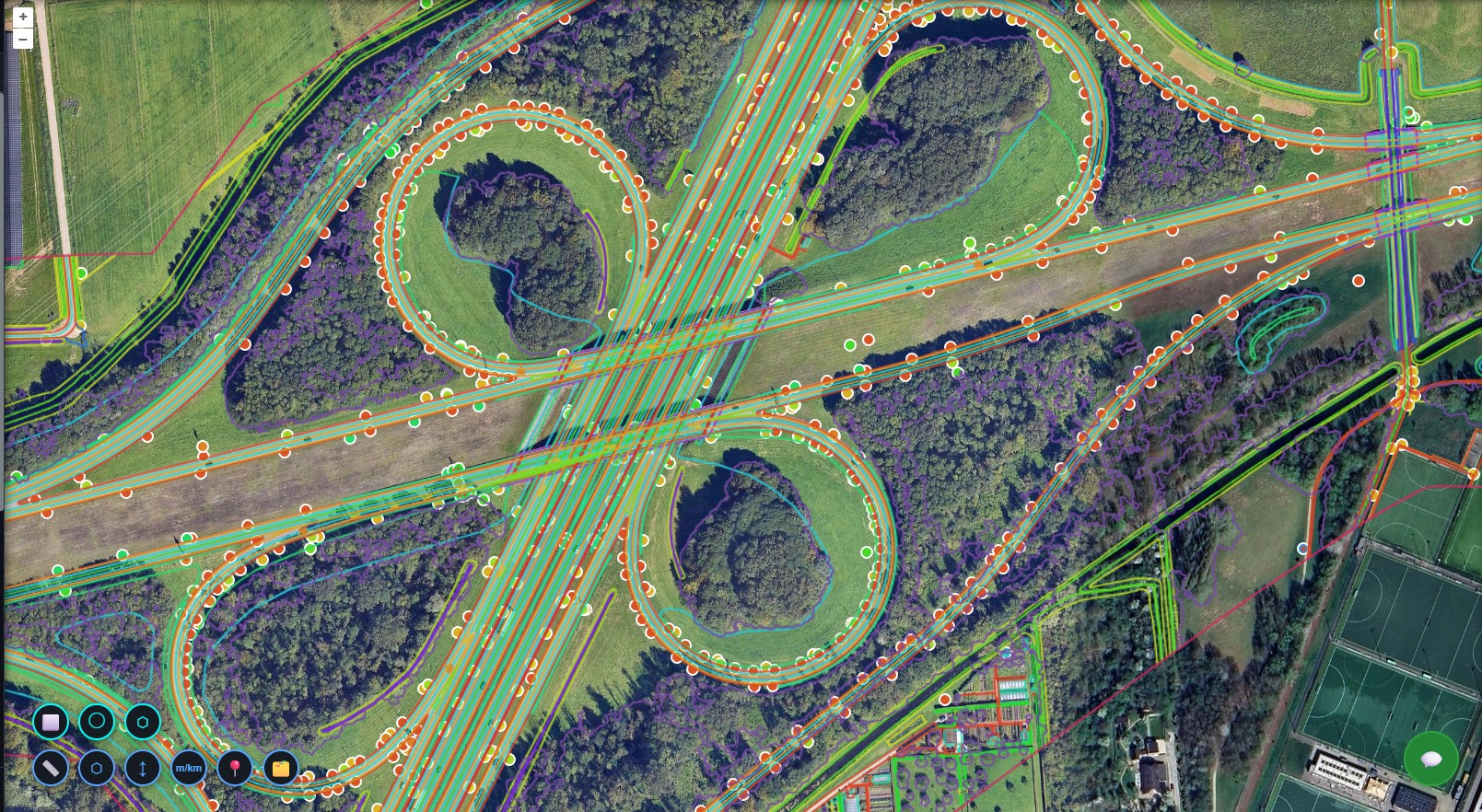
OpenStreetMap & Overture
Query global open geodata in plain language and pull it straight into your project.
French Geoplateforme
National parcels, buildings, roads, and water, plus IGN LiDAR HD elevation ingestion.
Dutch PDOK & AHN
Seventeen national vector layers plus AHN terrain, surface models, and point clouds.
Urban Regulatory Data
FEMA flood zones, zoning, and building permits for US cities and Dubai.
Travel-Time Isochrones
Drive, walk, and cycle reachability bands from any origin, delivered as styled layers.
Ready to deploy?
Get a demo, pricing, and a pilot plan tailored to your data stack.